A giant plume of dust from the Sahara Desert is making its way over the Atlantic Ocean and into the United States.
The cloud blanketed much of the Caribbean on Monday, extending 2,000 miles from Jamaica past Barbados. It’s expected to reach some of the southeastern United States in the coming days, but it will have lost some of its concentration by then.
“Those [Caribbean] islands tend to see more of an impact, more of a concentration where it can actually block out the sun a little bit at times,” says , lead hurricane expert with AccuWeather, to Dánica Coto at the .
While the dust led to coughing, sneezing and watery eyes as it swept through the Caribbean, according to the AP, it won’t be as dense once it reaches the continental U.S., potentially hitting states such as Florida, Alabama, Mississippi and Louisiana. You can monitor your local to see if you need to take special precautions, since dust particles can and impact individuals with respiratory issues.
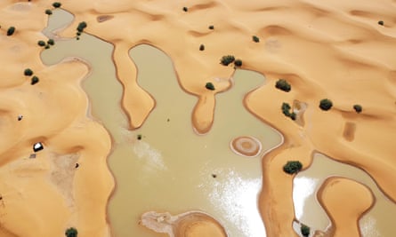
During the late spring and into the early fall each year, a large mass of dry, dusty air forms naturally over the Sahara Desert, according to the . That’s because the temperature difference between the hot, arid Sahara and the cooler, semi-arid region to its south leads to ripples in the lower atmosphere called “tropical waves.”
As these “waves” blow through the region, they pick up desert dust and loft it high into the air—creating a 2- to 2.5-mile-thick layer of haze roughly one mile above the ground. Then, winds from the African Easterly Jet carry the particles west over the Atlantic, with some dust moving out over the ocean every three to five days. This dust is known as the .
Every once in a while, like with this upcoming dust storm, the conditions are such that large amounts of dust can get all the way to the U.S. A smaller plume had last weekend.
“It happens every year; some years have more dust transportation across the Atlantic than others,” explains , a meteorologist at the National Weather Service office in Miami, to Amy Graff at the . “It’s like rinse and repeat every year, it’s part of a normal cycle of Earth’s oscillations.”
Once the next dust cloud reaches Florida, people can expect to see hazier skies. “Typically, we have nice blue skies, but with the dust, , because the particles themselves are red,” says of the University of Miami Center for Aerosol Science and Technology to the New York Times.
For many in the plume’s area, that means they will get to see more unusual sunrises and sunsets, since the sunlight that hits dust particles near the ground will result in orange and red hues, explains , a meteorologist at the National Weather Service’s Miami office, to Meghan Bartels at .
This dust plume is also arriving shortly after the start of the Atlantic hurricane season, which began on June 1 and is predicted to bring a this year. But scientists suggest the warmth and dryness that accompany the dust can work to suppress hurricane development, per Scientific American, since the storms need moisture to form. As a result, the dust could help prevent tropical storms from materializing in the region this week.
For now, meteorologists are , and the chance of a storm coming later this week remains low.
“Mother Nature is fascinating,” , a meteorologist at NOAA’s Hurricane Research Division, says to the New York Times. “It set up this Saharan dust factory right next to the hurricane nursery.”