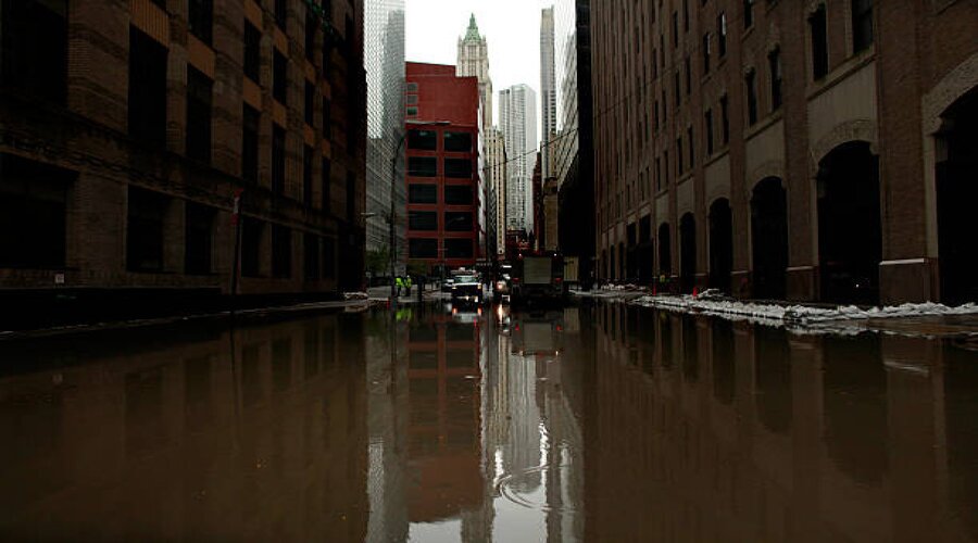
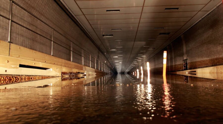
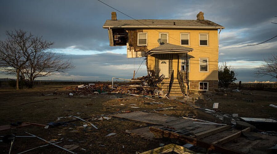
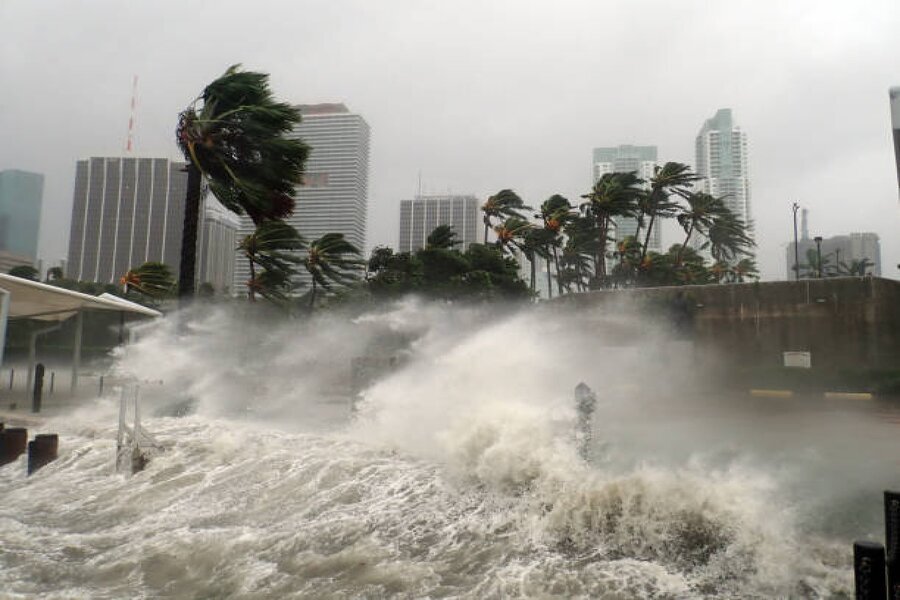
Hurricane Sandy made history as the largest Atlantic hurricane on record when it made landfall near Brigantine, N.J., Oct. 29, 2012. With wind gusts in excess of 75 miles per hour and storm surge that inundated much of the New York and New Jersey coasts with water four to eight feet high, the aftermath proved even worse. Sandy killed at least 117 people in the United States, caused more than $50 billion in damage, and stranded millions of people for days in their homes without electricity, resulting from crippled public transportation systems and severe fuel shortages.
In the days and weeks following the storm, the U.S. Army Corps of Engineers mobilized more than 800 personnel from worldwide locations to fulfill Federal Emergency Management Agency mission requests totaling $351 million to assist with the relief and recovery, primarily in New York and New Jersey. The Corps worked closely with its partners to dewater approximately 475 million gallons of salt water, install more than 200 generators to critical facilities such as hospitals and police stations, remove more than 300,000 cubic yards of debris in New York City alone, provide more than nine million liters of bottled water and begin repairs to projects.
In a national commitment to help recover from the second-most costly hurricane in our Nation’s history, Congress in January 2013 passed the Disaster Relief Appropriations Act of 2013. This act appropriated more than $5 billion to the Army Corps for the restoration and construction of federal projects in the impacted area. One year later, more than 200 projects and studies along the coastline from Florida to Maine and navigation channels inland to Ohio are planned and underway to restore projects to their design-level conditions and reduce the risks of future coastal storm damage.
The majority of USACE's recovery program is undertaken in the North Atlantic Division with more than 150 projects and studies totaling more than $4 billion. The Great Lakes and Ohio River Division and South Atlantic Division also were allocated funding to restore coastal storm risk reduction projects and navigation channels in their regions.
The California earthquake of April 18, 1906 ranks as one of the most significant earthquakes of all time. Today, its importance comes more from the wealth of scientific knowledge derived from it than from its sheer size. Rupturing the northernmost 296 miles (477 kilometers) of the San Andreas fault from northwest of San Juan Bautista to the triple junction at Cape Mendocino, the earthquake confounded contemporary geologists with its large, horizontal displacements and great rupture length. Indeed, the significance of the fault and recognition of its large cumulative offset would not be fully appreciated until the advent of plate tectonics more than half a century later. Analysis of the 1906 displacements and strain in the surrounding crust led Reid (1910) to formulate his elastic-rebound theory of the earthquake source, which remains today the principal model of the earthquake cycle.
Around 12:30 of 4th October 2010, the north-western corner of a vast reservoir containing some 30 million cubic meters of waste from an aluminum factory in the village of Ajka, in western Hungary, suddenly collapsed, giving rise to a red mud flow of nearly 1 million cubic meters, which poured out over the surrounding countryside causing an environmental catastrophe. The village of Kolontár was struck and partly submerged by the large mass of water mixed with toxic mud from the failed reservoir, taking the inhabitants of the area by surprise. Some houses and bridges collapsed following the heavy impact of the mud flow.
Within a few minutes, also the village of Devecser, located some kilometres downstream, was struck by the waste spill. Roads turned into streams of fluid red mud, which swept away dozens of cars, many houses and other buildings. Eventually, an area of over 40 square kilometres was affected by the disaster.
*Please click the green link for further info.
This composite satellite image shows the toxic spill - October 5, Left and October 8, Right - as it spreads over the landscape, in Ajka, Hungary. A million cubic meters of toxic sludge burst from a reservoir at an industrial plant on October 4 and has now reached the River Danube. Hungarian PM Viktor Orban has called the spill an "ecological tragedy".
A man removes mud from his garden in the flooded village of Kolontar, around 150kms southwest of Budapest on October 4, 2010. One person died and 60 were injured in western Hungary when a reservoir of residue from aluminum production broke and flooded two nearby villages with toxic red mud.
Cars are piled up in a flooded parking lot in Devecser, about 150 kms southwest of Budapest, on October 5, 2010 after the village was submerged on October 4 by toxic red sludge from a local aluminum plant. Three persons died and 60 were injured in western Hungary when a reservoir of residue from aluminum production broke and flooded two nearby villages.
A man walks in Devecser, about 150 kms southwest of Budapest, on October 5, 2010 after the village was flooded on October 4 by toxic red sludge from a local aluminum plant. Three persons died and 60 were injured in western Hungary when a reservoir of residue from aluminum production broke and flooded two nearby villages.
No one anticipated any unusual problems as the Exxon Valdez left the Alyeska Pipeline Terminal at 9:12 p.m., Alaska Standard Time, on March 23,1989. The 987 foot ship, second newest in Exxon Shipping Company's 20-tanker fleet, was loaded with 53,094,510 gallons (1,264,155 barrels) of North Slope crude oil bound for Long Beach, California. Tankers carrying North Slope crude oil had safely transited Prince William Sound more than 8,700 times in the 12 years since oil began flowing through the trans-Alaska pipeline, with no major disasters and few serious incidents. This experience gave little reason to suspect impending disaster. Yet less than three hours later, the Exxon Valdez grounded at Bligh Reef, rupturing eight of its 11 cargo tanks and spewing some 10.8 million gallons of crude oil into Prince William Sound.
Until the Exxon Valdez piled onto Bligh Reef, the system designed to carry 2 million barrels of North Slope oil to West Coast and Gulf Coast markets daily had worked perhaps too well. At least partly because of the success of the Valdez tanker trade, a general complacency had come to permeate the operation and oversight of the entire system. That complacency and success were shattered when the Exxon Valdez ran hard aground shortly after midnight on March 24.
*Please click the green link for further info.
The tanker Exxon Valdez is pulled across Prince William Sound by a tug boat, past floating ice, after having been freed from the reef it struck.
Oil spills from the crippled tanker Exxon Valdez the morning of March 24, 1989, after the vessel ran aground on Bligh Reef in Prince William Sound.
Boom surrounds the Exxon Valdez at its new temporary home just off Naked Island April 7, 1989.
Men walk past large piles of bags of oil debris resulting from the Exxon Valdez oil spill, 1989, in Alaska, USA.
In A.D. 62, a major earthquake shook Mount Vesuvius. Earthquakes continued for years as the magma chamber inside Vesuvius inflated. Finally, in August of A.D. 79, eruptions began. For 12 hours, fine grained ash, then coarse white pumice (a frothy, glass rock), and later a gray pumice, rained down on the city of Pompeii. Then, the eruption changed. Explosions created hot avalanches of rock, ash, and gases that sped down the volcano’s flank. Over two days, Pompeii and nearby Herculaneum were buried by these deadly ash flows. Many of their 20,000 citizens were killed. Today, a million people live within range of the volcano that could again erupt catastrophically.
*Please click the green link for further info.
Antique Illustration, Copyright has expired on this artwork. From my own archives, digitally restored. Mount Vesuvius is a somma-stratovolcano located on the Gulf of Naples in Campania, Italy.
A detailed landscape engraving showing a massive lava flow descending from Mount Vesuvius toward the town of San Sebastiano, with observers watching the natural disaster.
Casts of the bodies of the victims of the eruption frozen by the fiery clouds are exposed in the ruins of Pompeii which extend over several square kilometers at the foot of Vesuvius which destroyed it.
A detail of a human cast of a person who died during the eruption of Vesuvius in 79 AD, which destroyed the city of Pompeii, is on display in the permanent exhibition at the archaeological site.
On October 17, 1989, the San Francisco Bay area of the United States was jolted by the Loma Prieta earthquake. The quake’s epicenter was near Loma Prieta Peak in the Santa Cruz Mountains. The magnitude 6.9 quake was the most powerful the state had experienced in several years. The Loma Prieta earthquake was triggered by the mighty San Andreas Fault, where the massive Pacific plate slips northwestward. During the quake, the epicenter slipped up to two meters (six feet). The Loma Prieta earthquake caused 63 deaths, 3,757 injuries, and about $6 billion in damage. Many casualties occurred as parts of several transportation routes, including the San Francisco-Oakland Bay Bridge and a busy freeway, collapsed.
*Please click the green link for further info.
An apartment house in San Francisco's Marina District that was heavily damaged in the 1989 Loma Prieta Earthquake. The first floor of the building is partially collapsed.
Officials stand on the field after an earthquake struck before game three of the 1989 World Series between the Oakland Athletics and San Francisco Giants at Candlestick Park on October 17, 1989 in San Francisco, California.
White pickup truck totally flattened from collapsed highway 880 during bay area earthquake, sitting on bed of tow truck after its driver Tim Petersen was rescued by fire fighters in a four hour ordeal.
Downtown Santa Cruz was severely damaged as seen here the day after the the Loma Prieta earthquake, October 23, 1989.
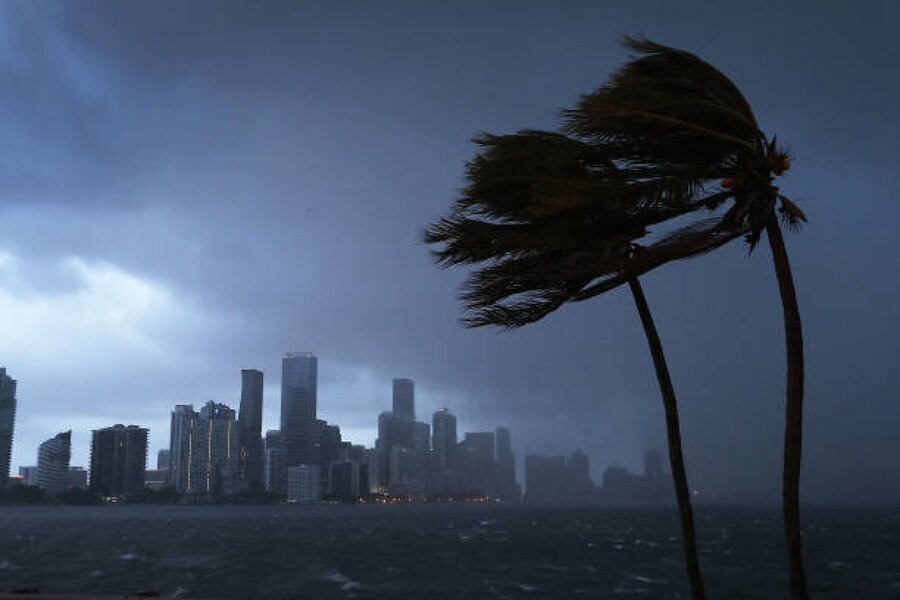
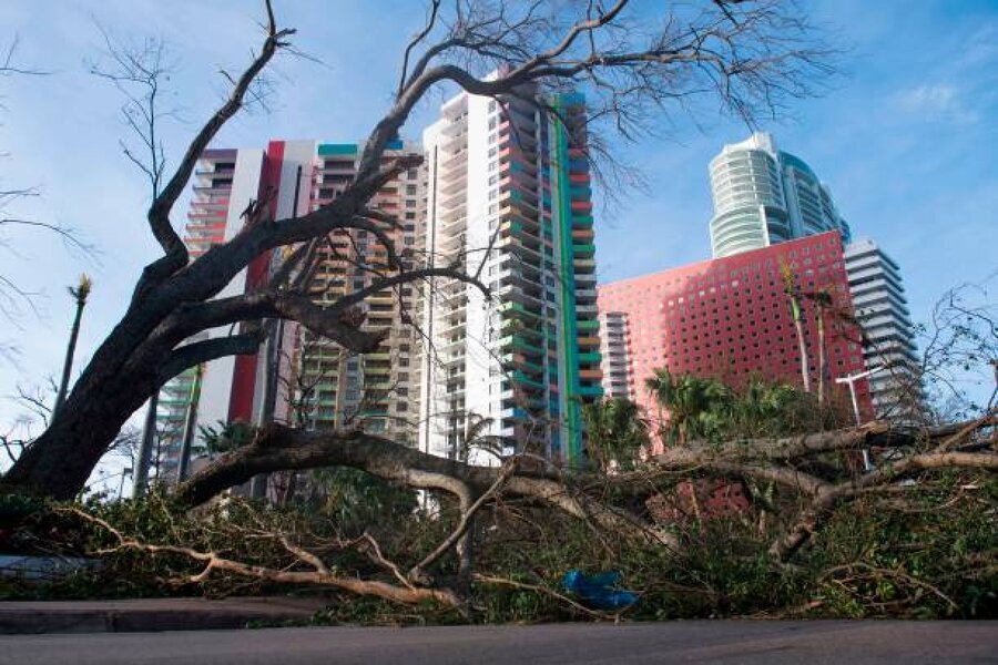
Hurricane Irma was a classic Cape Verde hurricane that will long be remembered for its severity and wide-ranging impacts to several islands in the Caribbean Sea and Florida. Like many of the most notorious Atlantic hurricanes, Irma began as a weak wave of low pressure accompanied by disorganized showers and thunderstorms which emerged off the west African coast on August 27th, near the peak of the Atlantic hurricane season. Such disturbances move off the African coast every few days during August and September, however, most of them fail to develop into tropical cyclones. This can be due to a number of factors, including blasts of dry, stable air from the Saharan desert, strong upper-level westerly winds, or a lack of the necessary atmospheric “spin” needed to generate a counterclockwise circulation.
Flash floods tore through northern Nepal on 26 August, claiming hundreds of lives, destroying homes, roads and bridges, and leaving entire communities displaces and cut off. The Nepal Red Cross Society (NRCS) is on the ground delivering clean water, shelter, first aid and emergency supplies. Donate today to help IFRC and the NRCS to scale up their response and bring life-saving assistance to those who need it most. Donations are made to the IFRC, which will channel resources to the NRCS and ensure accountability for their use.
School students hold LED candles as they gather to pay their homage to people who died in Nepal's flash flood, in Chennai.
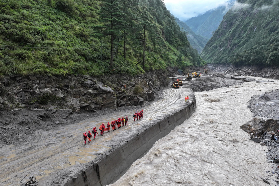
A drone view of firefighters conducting search and rescue operations at a damaged road leading to Gyirong Port after a mudslide, in Gyirong county, Shigatse, Tibet Autonomous Region, China August 28, 2026.
Army soldiers help a family disembark from a helicopter after they are rescued from an area affected by flash flooding in Nepal's Nuwakot district, Friday, Aug. 28, 2026.
People look at photographs of people killed in flash floods displayed outside a government hospital to help relatives identify the victims in Kathmandu, Nepal.
The floods that have devastated swathes of central China this summer remind us — not that there is often time to forget — that flood control has been a priority of Chinese governments for many centuries. Just like 2019, 2017, 2016, and 2010 — to give some recent examples — this year’s floods have affected millions of people across China.
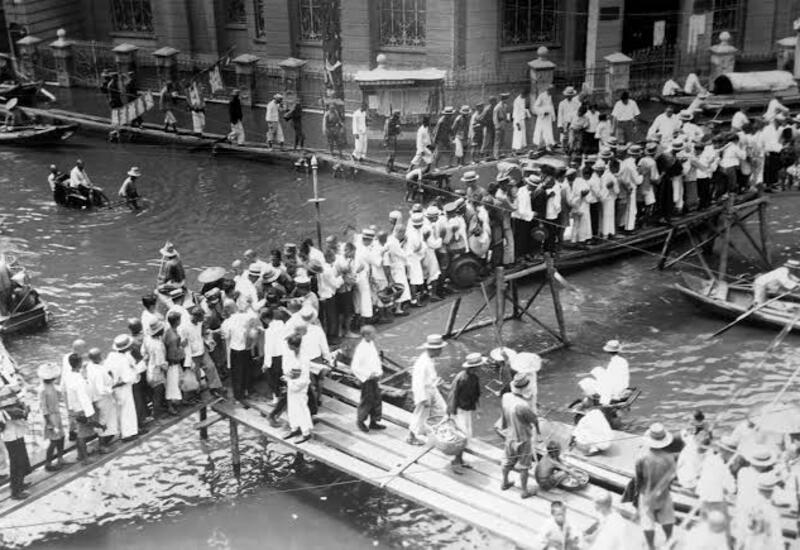
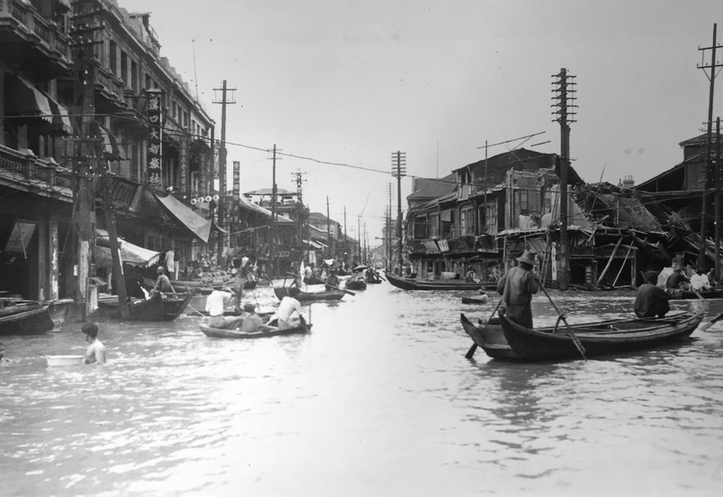
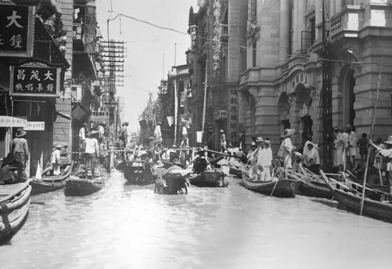
This week, we look back to 1931, when maybe the worst of these floods inundated an area the size of New England across central China, affecting perhaps 50 million people. As with most floods of this scale, it is difficult to pinpoint a moment when it turned disastrous.
The flooding itself lasted for months, from June through at least October, depending on the specific place, and of course the destruction and consequences lasted much longer than that. But August 25 to 26 was an exclamation point on months of disaster, the moment when as many as 15,000 people died when the levees around the city of Gaoyou broke.
*Please click the green link for further info.
This historic photo shows people using temporary wooden walkways to navigate flooded streets during the devastating 1931 China floods in Wuhan.
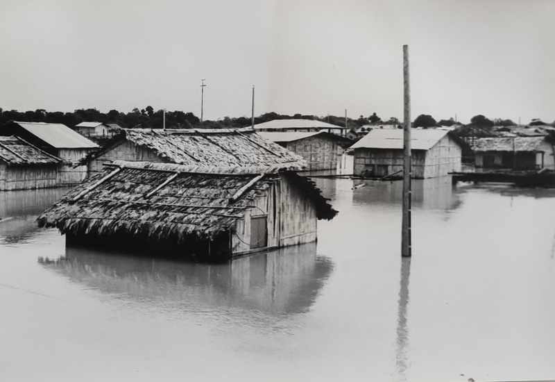
The image shows the city of Babahoyo in Ecuador during severe flooding caused by the El Niño weather phenomenon around 1980.
This historic photograph shows a flooded street in Hankow (Wuhan), China, during the catastrophic 1931 Yangtze River floods.
The image shows a flooded street in Wuhan during the devastating 1931 China floods.
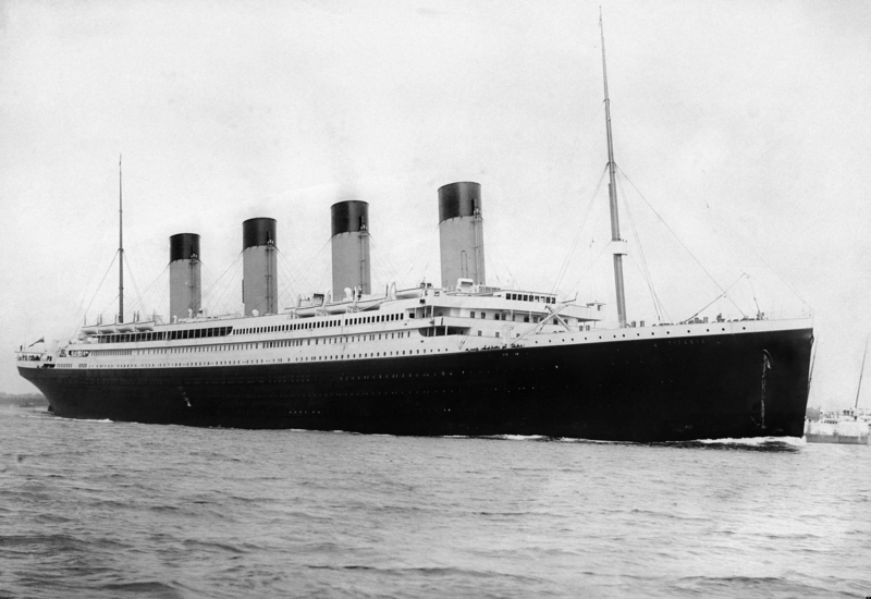
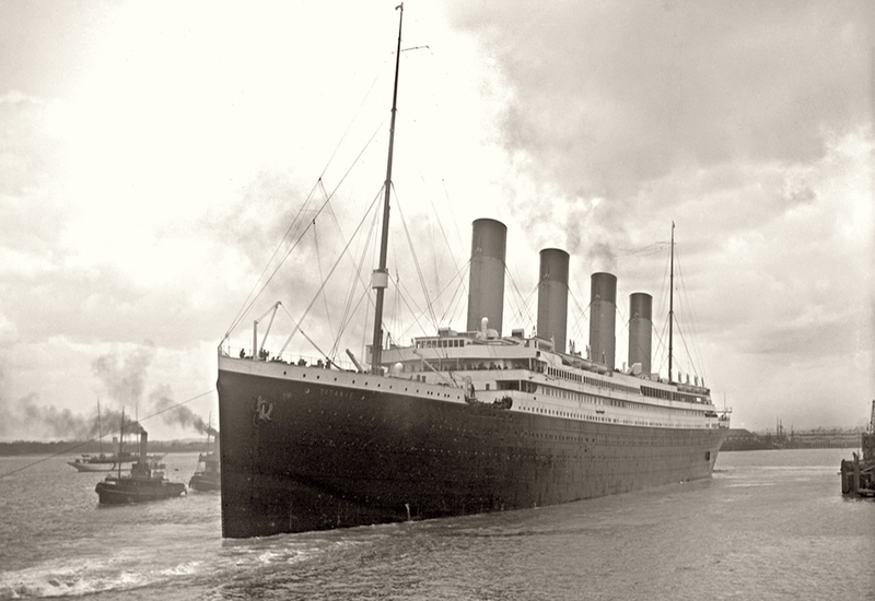
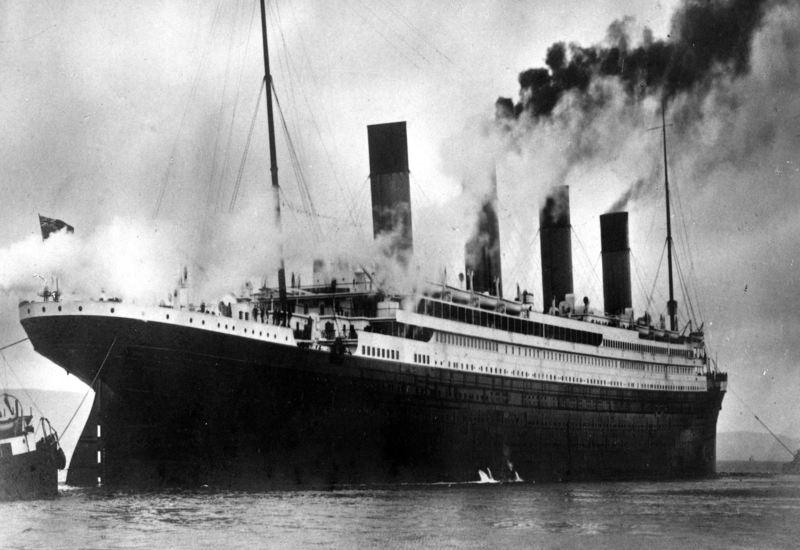
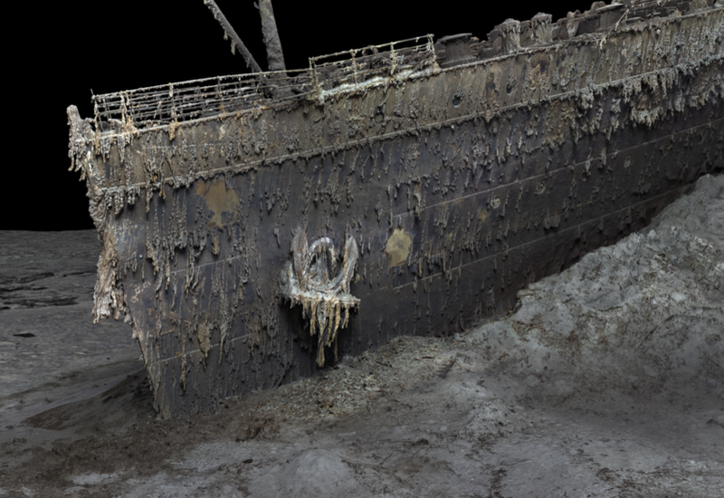
The R.M.S. Titanic is perhaps the most famous shipwreck in our current popular culture. Titanic was a British-registered ship in the White Star line that was owned by a U.S. company in which famed American financier John Pierpont "JP" Morgan was a major stockholder. Titanic was built in Belfast, Northern Ireland by Harland & Wolff for transatlantic passage between Southampton, England and New York City. It was the largest and most luxurious passenger ship of its time and was reported to be unsinkable. Titanic, launched on May 31, 1911, and set sail on its maiden voyage from Southampton on April 10, 1912, with 2,240 passengers and crew on board. On April 15, 1912, after striking an iceberg, Titanic broke apart and sank to the bottom of the ocean, taking with it the lives of more than 1,500 passengers and crew.
Forty years ago, an Indian city became the site of one of the world's worst industrial disasters.
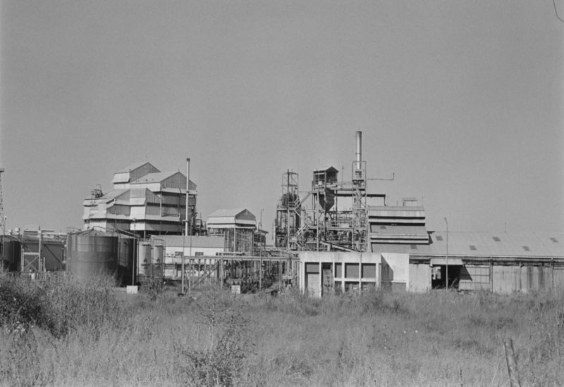
On the night of 2 December, 1984, a poisonous gas leaked from Union Carbide India's pesticide plant in Bhopal, enveloping the central Indian city in a deadly fog which killed thousands and poisoned about half-a-million people.
According to government estimates, around 3,500 people died within days of the gas leak and more than 15,000 in the years since. But activists say that the death toll is much higher, and that victims continue to suffer from the side-effects of being poisoned. In 2010, an Indian court convicted seven former managers at the plant, handing down minor fines and brief prison sentences. But many victims and campaigners say that justice has still not been served, given the magnitude of the tragedy. Union Carbide was a US company which Dow Chemicals bought in 1999.
*Please click the green link for further info.
The Union Carbide factory-the site of the poisonous gas leak.
A doctor treats a blinded victim in the immediate aftermath of the gas leak.
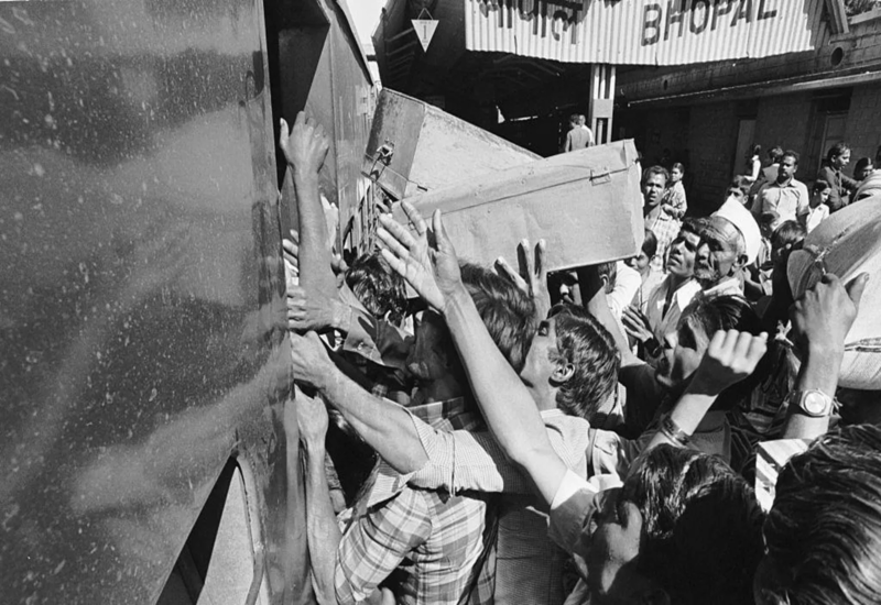
The gas leak triggered an exodus as people rushed to leave Bhopal in trains and buses.
A survivor lights a candle in 2002 in front of portraits of some of the thousands killed by the gas leak.